- StormGeo Launches River Monitoring and Alerting Solution
StormGeo Launches River Monitoring and Alerting Solution
The StormGeo Vortex Portal offers new feature, River Monitor, providing multiple data sources to clients when a river is forecast to rise above key thresholds.
Houston, April 28, 2020 - StormGeo, a leading global provider of advanced weather intelligence and decision support services, today announced a new feature of the StormGeo Vortex Portal, River Monitor.
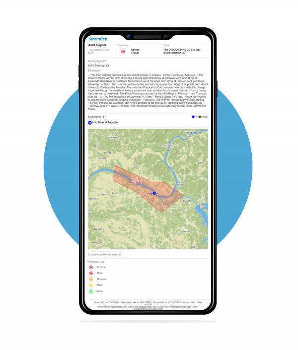
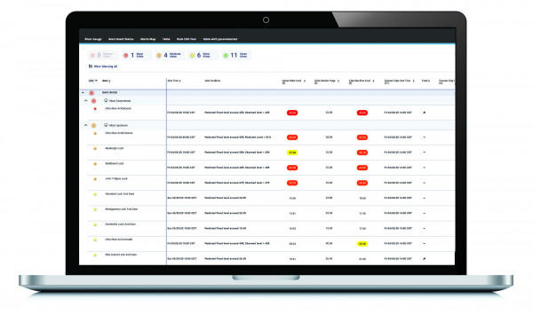
Through River Monitor, users can receive data on both predicted and observed river level thresholds at locations following a river’s path. The feature comes with customization options, such as the ability to only show thresholds near a port facility or display an entire river network.
River Monitor combines data from multiple sources, including: five-day forecast water levels at river gauge points from the US Advanced Hydrologic Prediction Service; river gauge observations; five-day precipitation amount forecasts; and an optimized blend of radar-estimated and recently observed rain gauge levels. The feature then issues alerts based on a client’s customized threshold parameters.

In addition, through River Monitor, water level thresholds can be tracked at multiple points along a river either using the minor, moderate, and major flood stage designations set by the local river authority. Customized levels can also be set based on specific action or shut down triggers for ports, terminals, or at-risk locations along a river. As water levels increase, color-coded alerts are issued based on these custom-set thresholds for either predicted or observed levels.
As with other features of the StormGeo Vortex portal, clients are able to receive a daily overview of forecast and observed data to take necessary proactive measures. All alerts, daily updates and additional maps are available on the StormGeo Vortex portal.

“StormGeo is thrilled to include River Monitor among the robust features of StormGeo Vortex portal,” said Henk Grouls, StormGeo Managing Director and Global VP of Terra. “It allows businesses to make timely directional changes for their operations, ensuring the safety of employees and assets, as prevention and preparedness are the first step to weather risk mitigation.”
“River Monitor is a valuable enhancement for clients with terminal sites and barge traffic operations on navigable rivers,” said Don Shelly, Head of StormGeo Oil and Gas, North America. “Being able to interactively monitor multiple critical points in real-time via the StormGeo Vortex portal enables better decisions and operational efficiency, particularly with the ability for a client to customize their unique operational thresholds.”
The River Monitoring and Alerting solution is now available – contact StormGeo for more information.
About StormGeo
StormGeo is a global provider of weather intelligence and decision support services, with leading solutions for shipping, oil and gas, renewable energy, utilities, cross industry and aviation. StormGeo’s products and services help clients manage risk, optimize performance, reduce costs and increase revenue. The company has 24 offices in 18 countries, including eight 24/7/365 global operations centers. As a participant in the UN Global Compact for Sustainable Ocean Business, our passion for weather and the protection of natural resources motivates us to support our clients in making informed, environmentally responsible business decisions. For more information, visit stormgeo.com
